Where are we being watched? Visualizing the pervasiveness of surveillance in the Metro Atlanta area.
Using Mapbox and data from Georgia Department of Transportation to map precise data on Metro Atlanta’s ubiquitous surveillance network.
Made in collaboration with Elizza Kaimachiande and Vyshnavi Namani.
Check it out here!

In 2007, the Atlanta Police Foundation (APD) launched Operation Shield, an initiative to grow the city's existing surveillance network from 17 cameras at the time to 24,800 and rising. The city now has over double the amount of cameras per 1000 people than the 2nd ranked most surveilled city in the United States, making it the more surveilled city in the coutry by a wide margin.

The APD says that this surveillance network has had a direct impact on the drop of crime by 25% to 50% in areas where cameras have been installed. However, when we look at data on the correlation between CCTV camera presence and crime indices around the United States, we can see that even with the 48.93 cameras per 1000 citizens, Atlanta has a crime index of 62.30 which is the 13th highest in the US. This illustrates clearly that the presence of cameras has no direct correlation with crime rates.

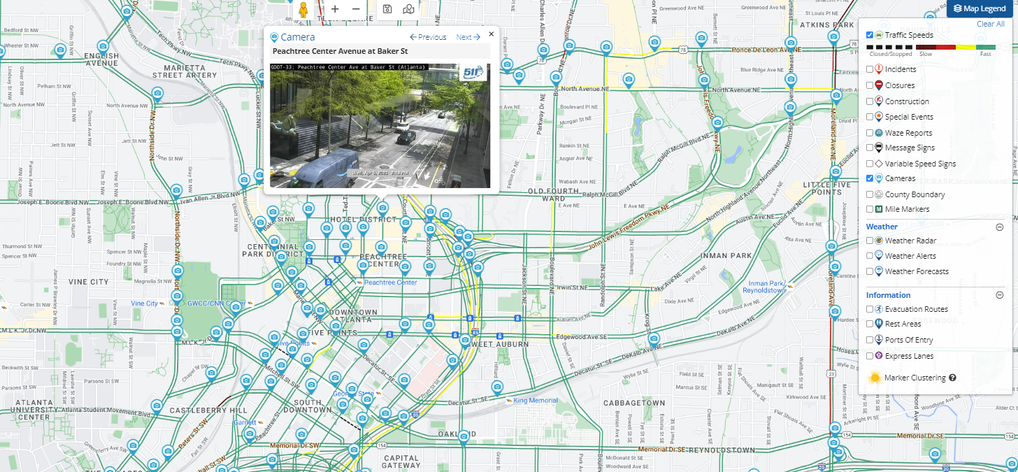
There is not much (if any) transparency around state surveillance data on the general public. Through some investigation on what open source collections of data existed for use to use, we were able to find data on traffic cameras from the Georgia Department of Transportation (GDOT) which represents roughly 12% of the Atlanta Surveillance network. This data source houses the precise location and camera feed of every traffic camera in the state of Georgia. Link to the dataset
The first version of the map was explored using the mapping tool Felt to display the data from CCTV cameras just to get an idea of what data we wanted to present and how.
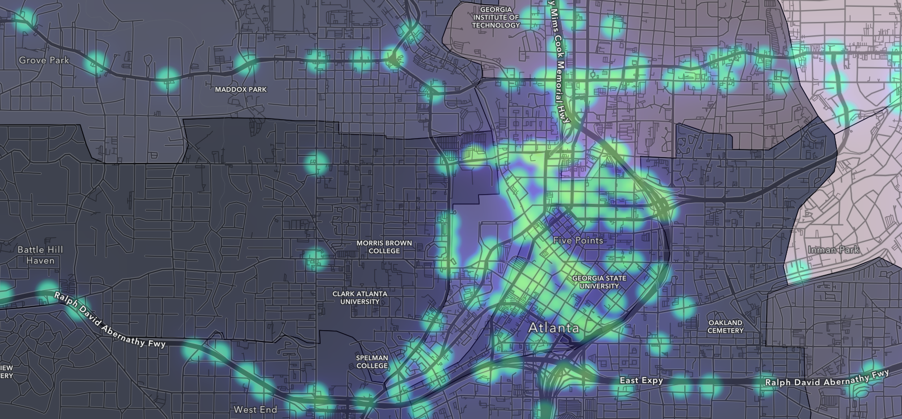
The second version was built using ArcGIS and used the visual aesthetic of security camera footage by having a greyscale basemap and glowing green points representing cameras.

In order to optimize for more control over the aesthtics and to open up the potential for scaling the project in the future, the map was translated over to Mapbox. This version can be found at zarya-ajasin.github.io/eyesonatl/
